Climate
Showing posts with label UNESCO. Show all posts
Saturday, November 30, 2013
Mount Emei - Sacred Mountain
Mount Emei (Chinese: 峨嵋山; pinyin: Éméi Shān; Wade–Giles: O2-mei2 Shan1, pronounced [ɤ̌měɪ̯ ʂán]) is a mountain in Sichuan province, China. Its name is usually written as "峨眉山" and occasionally "峩嵋山" or "峩眉山" but all three are translated as Mount Emei or Mount Emeishan (a linguistic tautology). The word 峨 can mean "high" or "lofty", but the mountain's name is merely a toponym that carries no additional meaning.
Orographically, Mt. Emei sits at the western rim of the Sichuan Basin. The mountains west of it are known as Daxiangling. A large surrounding area of countryside is geologically known as the Permian Emeishan Large Igneous Province, a large igneous province generated by the Emeishan Traps volcanic eruptions during the Permian Period. At 3,099 metres (10,167 ft), Mt. Emei is the highest of the Four Sacred Buddhist Mountains of China.
Administratively, Mt. Emei is located near the county-level city of the same name (Emeishan City), which is in turn part of the prefecture-level city of Leshan. It was made a UNESCO World Heritage Site in 1996.
Indigenous animals
Visitors to Mount Emei will likely see dozens of Tibetan Macaques who can often be viewed taking food from tourists. Local merchants sell nuts for tourists to feed the monkeys. Some monkeys may be seen eating human food such as potato chips and even drinking soda from discarded bottles.
The Emei Shan Liocichla, a passerine bird, as well as the Emei Music Frog, a vocal frog, are named after the site.
Flora
Mount Emei is known for its high level of endemism and approximately 200 plant species in various plant families have been described from this mountain.
Sacred mountain
Mount Emei is one of the Four Sacred Buddhist Mountains of China, and is traditionally regarded as the bodhimaṇḍa, or place of enlightenment, of the bodhisattva Samantabhadra. Samantabhadra is known in Mandarin as Pǔxián Púsà (普賢菩薩).
16th and 17th century sources allude to the practice of martial arts in the monasteries of Mount Emei made the earliest extant reference to the Shaolin Monastery as Chinese boxing's place of origin.
Buddhist architecture on Emei
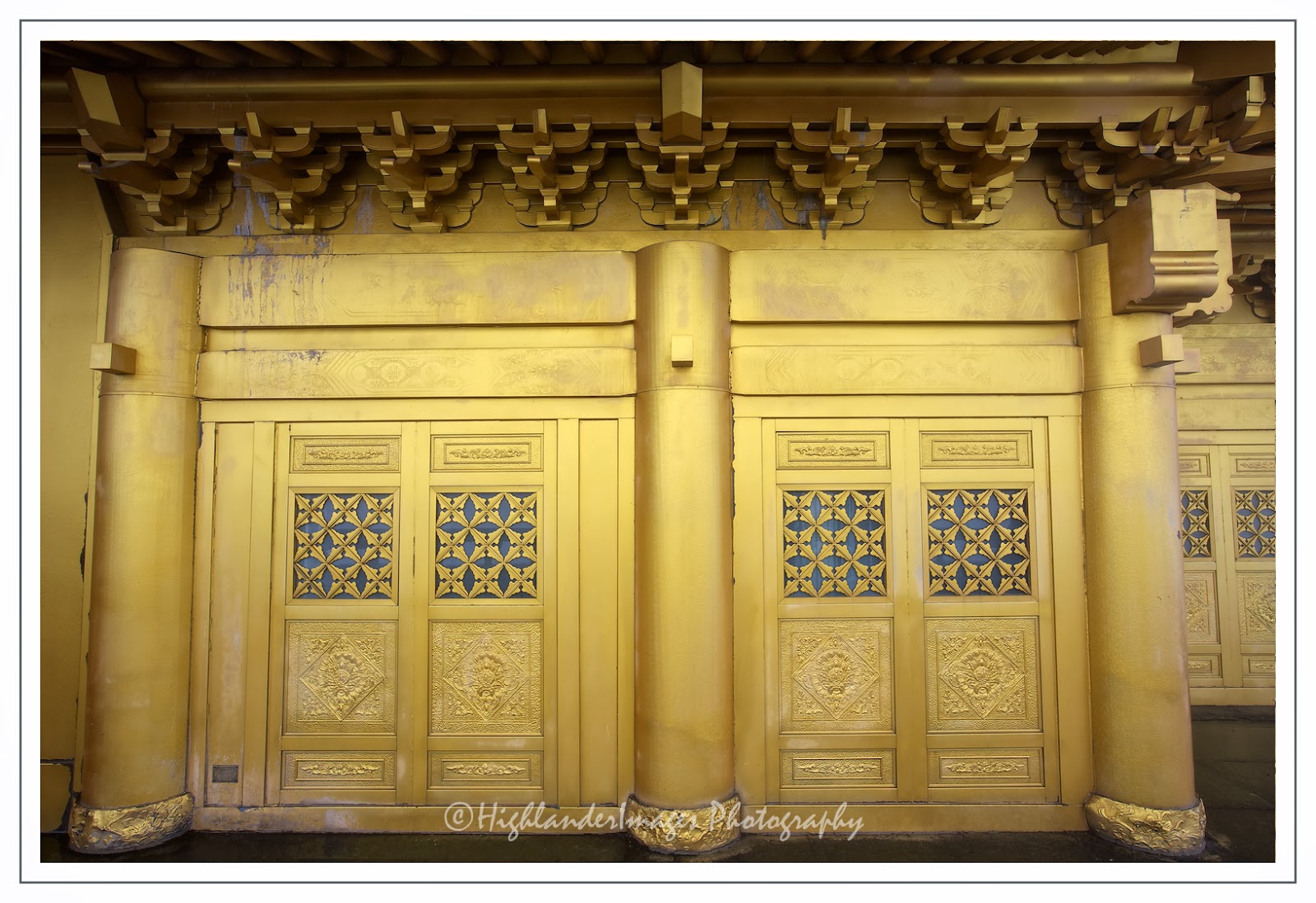
This is the location of the first Buddhist temple built in China in the 1st century CE. The site has seventy-six Buddhist monasteries of the Ming and Qing period, most of them located near the mountain top. The monasteries demonstrate a flexible architectural style that adapts to the landscape. Some, such as the halls of Baoguosi, are built on terraces of varying levels, while others, including the structures of Leiyinsi, are on raised stilts. Here the fixed plans of Buddhist monasteries of earlier periods were modified or ignored in order to make full use of the natural scenery. The buildings of Qingyinge are laid out in an irregular plot on the narrow piece of land between the Black Dragon River and the White Dragon River. The site is large and the winding foot path is 50 km (31 mi), taking several days to walk.
Cable cars ease the ascent to the two temples at Jinding (3,077 m), an hour's hike from the mountain's peak.
Great spectacles of Mount Emei include the sunrise and Clouds Sea seen from the Golden Summit of the mountain.
The sunrise is very varied, but optimally begins with the ground and sky being in the same dark purple, soon showing rosy clouds, followed by a bright purple arc and then a semicircle where the sun is coming up.
The Clouds Sea includes several cloud phenomena, e.g. clouds appearing in the sky above, in addition to the regular clouds beneath.
Climate
The summit of Mount Emei has an alpine subarctic climate, with long, cold (but not severely so) winters, and short, cool summers. The monthly 24-hour average temperature ranges from −5.7 °C (21.7 °F) in January to 11.6 °C (52.9 °F), and the annual mean is 3.07 °C (37.5 °F). Precipitation is common year-round (occurring on more than 250 days), but due to the influence of the monsoon, rainfall is especially heavy in summer, and more than 70% of the annual total occurs from June to September.
Labels:
Buddhist,
Chengdu,
China,
Emeishan,
Leshan,
Mount Emei,
Sichuan,
temple,
UNESCO,
World Heritage Site
Tuesday, November 26, 2013
Colours of Jiuzhaigou
![]() |
| Long Lake |
Jiuzhaigou Valley (simplified Chinese: 九寨沟; traditional Chinese: 九寨溝; pinyin: Jiǔzhàigōu; literally "Valley of Nine Villages"; Tibetan: གཟི་རྩ་སྡེ་དགུ།, Wylie: gzi-rtsa sde-dgu, ZYPY: Sirza Degu) is a nature reserve and national park located in the north of Sichuan, China.
Jiuzhaigou Valley is part of the Min Mountains on the edge of the Tibetan Plateau and stretches over 72,000 hectares (180,000 acres). It is known for its many multi-level waterfalls, colorful lakes, and snow-capped peaks. Its elevation ranges from 2,000 to 4,500 metres (6,600 to 14,800 ft).
Jiuzhaigou Valley was inscribed by UNESCO as a World Heritage Site in 1992 and a World Biosphere Reserve in 1997. It belongs to the category V (Protected Landscape) in the IUCN system of protected area categorisation.
![]() |
| Location of Jiuzhaigou Valley |
![]() |
| Long Lake |
![]() |
| Long Lake |
![]() |
| Tiger Lake |
![]() | |
|
![]() |
| Close to Five Coloured Pool |
![]() | |
|
History
Jiuzhaigou (literally "Nine Village Valley") takes its name from the nine Tibetan villages along its length. The remote region was inhabited by various Tibetan and Qiang peoples for centuries. Until 1975 this inaccessible area was little known. Extensive logging took place until 1979, when the Chinese government banned such activity and made the area a national park in 1982. An Administration Bureau was established and the site officially opened to tourism in 1984; layout of facilities and regulations were completed in 1987.
The site was inscribed by UNESCO as a World Heritage Site in 1992 and a World Biosphere Reserve in 1997. The tourism area is classified as a AAAAA scenic area by the China National Tourism Administration.
Since opening, tourist activity has increased every year: from 5,000 in 1984 to 170,000 in 1991, 160,000 in 1995, to 200,000 in 1997, including about 3,000 foreigners. Visitors numbered 1,190,000 in 2002.[4] As of 2004, the site averages 7,000 visits per day, with a quota of 12,000 being reportedly enforced during high season. The Town of Zhangzha at the exit of the valley and the nearby Songpan County feature an ever-increasing number of hotels, including several luxury five-stars, such as Sheraton.
Developments related to mass tourism in the region have caused concerns about the impact on the environment around the park.
![]() | |
|
![]() | |
|
![]() | |
|
![]() | |
|
Population
Seven of the nine Tibetan villages are still populated today. The main agglomerations that are readily accessible to tourists are Heye, Shuzheng and Zechawa along the main paths that cater to tourists, selling various handicrafts, souvenirs and snacks. There is also Rexi in the smaller Zaru Valley and behind Heye village are Jianpan, Panya and Yana villages. Guodu and Hejiao villages are no longer populated.
Penbu, Panxing and Yongzhu villages lie along the road that passes through the town of Jiuzhaigou/Zhangza outside the valley.
In 2003, the permanent population of the valley was about 1,000 comprising 112 families, and due to the protected nature of the park, agriculture is no longer permitted so the locals now rely on tourism and local government subsidies to make a living.
![]() | |
|
![]() | |
|
![]() | |
|
![]() | |
|
Geography & Climate
Jiuzhaigou lies at the southern end of the Minshan mountain range, 330 km (205 mi) north of the provincial capital of Chengdu. It is part of the Jiuzhaigou County (formerly Nanping County) in the Aba Tibetan Qiang Autonomous Prefecture of northwestern Sichuan province, near the Gansu border.
The valley covers 720 km2 (278 sq mi), with buffer zones covering an additional 600 km2 (232 sq mi). Its elevation, depending on the area considered, ranges from 1,998 to 2,140 m (at the mouth of Shuzheng Gully) to 4,558-4,764 m (on Mount Ganzigonggai at the top of Zechawa Gully).
The climate is subtropical to temperate monsoon with a mean annual temperature of 7.8 °C, with means of -3.7 °C in January and 16.8 °C in July. Total annual rainfall is 761 mm but in the cloud forest it is at least 1,000 mm. 80% of rainfall occurs between May and October.
![]() | |
|
![]() | |
|
![]() |
| Close to Resting Dragon Lake |
![]() |
| Sparkling Lake |
Ecology
Jiuzhaigou's ecosystem is classified as temperate broad-leaf forest and woodlands, with mixed mountain and highland systems. Nearly 300 km2 (116 sq mi) of the core scenic area are covered by virgin mixed forests. Those forests take on attractive yellow, orange and red hues in the autumn, making that season a popular one for visitors. They are home to a number of plant species of interest, such as endemic varieties of rhododendron and bamboo.
Local fauna includes the endangered giant panda and golden snub-nosed monkey. Both populations are very small (less than 20 individuals for the pandas) and isolated. Their survival is in question in a valley subject to increasing tourism. Jiuzhaigou is also home to approximately 140 bird species.
![]() |
| Sparkling Lake |
![]() |
| Arrow Bamboo Lake |
![]() |
| Five Flower Lake |
![]() | |
|
Geology and hydrology
Jiuzhaigou's landscape is made up of high-altitude karsts shaped by glacial, hydrological and tectonic activity. It lies on major faultlines on the diverging belt between the Qinghai-Tibet Plate and the Yangtze Plate, and earthquakes have also shaped the landscape. The rock strata is mostly made up of carbonate rocks such dolomite and tufa, as well as some sandstone and shales.
The valley includes the catchment area of three gullies (which due to their large size are often called valleys themselves), and is one of the sources of the Jialing River, part of the Yangtze River system.
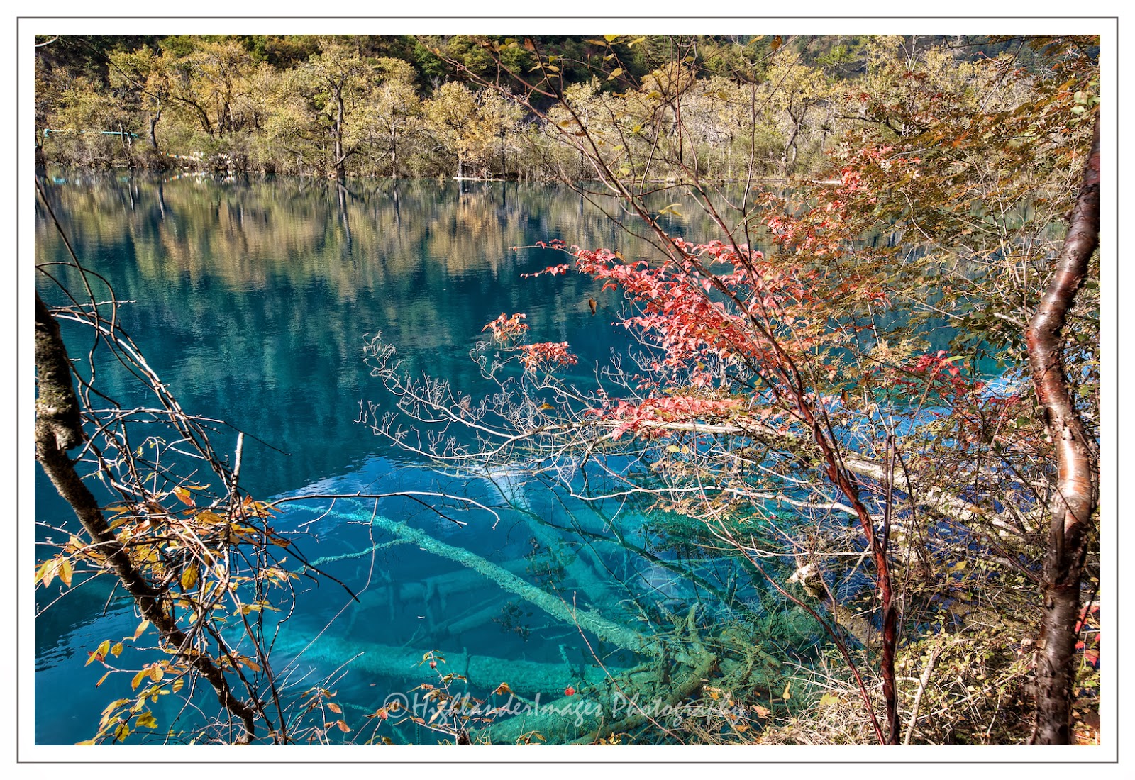
Jiuzhaigou's best-known feature is its dozens of blue, green and turquoise-colored lakes. The local Tibetan people call them "Haizi" in Chinese, meaning "son of the sea". Originating in glacial activity, they were dammed by rockfalls and other natural phenomena, then solidified by processes of carbonate deposition. Some lakes have a high concentration of calcium carbonate, and their water is very clear so that the bottom is often visible even at high depths. The lakes vary in color and aspect according to their depths, residues, and surroundings.
Some of the less stable dams and formations have been artificially reinforced, and direct contact with the lakes or other features is forbidden to tourists.
![]() | |
|
![]() | |
|
![]() | |
|
![]() | |
|
Subscribe to:
Posts (Atom)