Showing posts with label desert. Show all posts

Monday, October 13, 2014

Death Valley - Mohave Desert, California


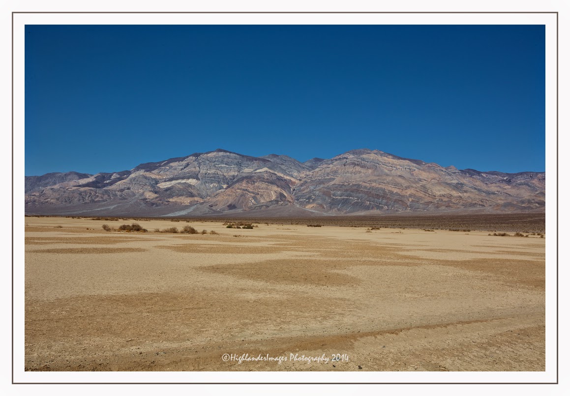
Death Valley is a desert valley located in Eastern California's Mojave Desert, the lowest, driest, and hottest area in North America.

Death Valley's Badwater Basin is the point of the lowest elevation in North America at 282 feet (86 m) below sea level. This point is 84.6 miles (136.2 km) east-southeast of Mount Whitney, the highest point in the contiguous United States with an elevation of 14,505 feet (4,421 m). Death Valley's Furnace Creek holds the record for the highest reliably reported air temperature in the world, 134 °F (56.7 °C) on July 10, 1913.


Located near the border of California and Nevada, in the Great Basin, east of the Sierra Nevada mountains, Death Valley constitutes much of Death Valley National Park and is the principal feature of the Mojave and Colorado Deserts Biosphere Reserve. It is located mostly in Inyo County, California. It runs from north to south between the Amargosa Range on the east and the Panamint Range on the west; the Sylvania Mountains and the Owlshead Mountains form its northern and southern boundaries, respectively. It has an area of about 3,000 sq mi (7,800 km2). The highest point in Death Valley itself is Telescope Peak in the Panamint Range, which has an elevation of 11,043 feet (3,366 m).


Our route through Death Valley from Las Vegas to Lone Pine took us on Route 160 through the town of Pahrump after which we turned west on Bell Vista Road and eventually over the state line between Arizona and California. Crossing the intersection with Route 127 we then headed on California 190 into Death Valley.


Entering Death Valley National Park we had to buy a park entrance ticket at an automated machine which took only credit cards causing some problems for a few visitors whose cards were not accepted. Luckily my transaction was painless and we were soon on our way into the valley.


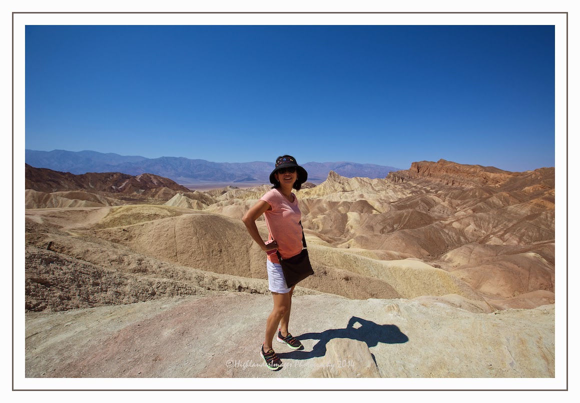
Zabriskie Point is a part of Amargosa Range located east of Death Valley in Death Valley National Park in California, United States noted for its erosional landscape. It is composed of sediments from Furnace Creek Lake, which dried up 5 million years ago—long before Death Valley came into existence.


The location was named after Christian Brevoort Zabriskie, vice-president and general manager of the Pacific Coast Borax Company in the early 20th century. The company's twenty-mule teams were used to transport borax from its mining operations in Death Valley.


Twenty-mule teams were teams of eighteen mules and two horses attached to large wagons that ferried borax out of Death Valley from 1883 to 1889. They traveled from mines across the Mojave Desert to the nearest railroad spur, 165 miles (275 km) away in Mojave. The routes were from the Harmony and Amargosa Borax Works to Daggett, California, and later Mojave, California. After Harmony and Amargosa shut down in 1888, the mule team's route was moved to the mines at Borate, 3 miles east of Calico, back to Daggett. There they worked from 1891 until 1898 when they were replaced by the Borate and Daggett Railroad.

The wagons were among the largest ever pulled by draft animals, designed to carry 10 short tons (9 metric tons) of borax ore at a time.


Heading west on California 190 through the lowest part of the valley where the temperature was reaching 44 deg C we soon reached the small settlement called Furnace Creek. The population of Furnace Creek was 24 at the 2010 census, down from 31 at the 2000 census. The elevation of the village is 190 feet (58 m) below sea level. We stopped here and had lunch in the Badwater Saloon. There is little here other than a General Store, a cafe, a gas station, a few houses and the local rusting fire truck.


We stopped at Padre Crowley Point, a scenic point providing panoramic views of the northern end of the Panamint valley in Death Valley National Park. This point is named after Father John Crowley, Padre of the desert 1891 - 1940. The plaque at the point reads ….


PADRE CROWLEY POINT
In memory of the Padre of the Desert

FATHER JOHN J. CROWLEY
1891-1940

From the snowy heights of the Sierras beyond the deep shadows of Death Valley beloved and trusted by people of all faiths he led them toward life's wider horizons.

Wednesday, October 08, 2014

Las Vegas - Desert Mirage


"If you aim to leave Las Vegas with a small fortune, 
go there with a large one"

Anonymous

Arriving into Las Vegas after hours of driving through the stark and beautiful wilderness of the Mohave Desert is like seeing a mirage. The dense concentration of brash neon-coloured, Disney-like buildings is a full-frontal assault on your senses after the calm and solitude of the desert on I-15. This fake, plastic city is raw, cheap, sleazy, larger than life and seems to attract exactly the same characteristics in its human visitors.

On a road trip around California it was hard to try and avoid Las Vegas in the neighboring state of Nevada, especially with a visit to the Grand Canyon in our sights. I guess you have to at least see and experience the place before making a judgement. My pre-judgement was to be 100% correct.


However an exciting helicopter excursion to the Grand Canyon would provide the sweetener for me to endure the 2 days at the MGM Grand Hotel. The hotel was immense ... It was at least a 2 block hike from the main reception (through the vast expanse of the gambling hall) till we reached our accommodation wing then another long walk along endless corridors till we found our room. There was an upcoming boxing match being held at the hotel in a few days time so the was a large boxing ring setup in the foyer.


Las Vegas Boulevard or "The Strip" was right next to the hotel so we did the cursory walk around and grabbed a few shots of the area. During this walk I found the gallery of landscape photographer, Rodney Lough Jr. which was of interest. There were some very nice large prints of landscapes taken with a large format camera but the asking price of the photographs were outrageous.


At night Vegas came into its own and the streets looked a little more photogenic, although still fake and Disney-like. Along the walkways and bridges interconnecting the luxury hotels and gambling casinos were a large number of down-and-outs begging which contrasted vividly with apparent "rich" look of the surroundings.


Along the strip from our hotel was the Luxor Las Vegas. With its large black pyramid complete with vertical light shining into the sky and large Sphinx at the entrance it was somewhat reminiscent of a Pink Floyd album cover. The 30-story hotel, owned and operated by MGM Resorts International, has a 120,000-square-foot (11,000 m2) casino with over 2,000 slot machines and 87 table games.

The hotel is named after the city of Luxor (ancient Thebes) in Egypt. Luxor is the second largest hotel in Las Vegas (the largest being the MGM Grand) and the eighth largest in the world. As of 2010, the Luxor has a 4 Key rating from the Green Key Eco-Rating Program, which evaluates "sustainable" hotel operations.


We attended a spectacular show, Kà, at our hotel by Cirque du Soleil which was impressive. Kà describes the story as "the coming of age of a young man and a young woman through their encounters with love, conflict and the duality of Kà, the fire that can unite or separate, destroy or illuminate." Kà features 80 artists from around the world, and is a gravity-defying production featuring a powerfully emotive soundtrack that enhances the innovative blend of acrobatic feats, Capoeira dance, puppetry, projections and martial arts.


Doing things in reverse we visited the "Welcome to Las Vegas" sign as we left this city, took the required photos then quickly left on the road into the natural and more realistic confines of the desert en-route to Death Valley. I was looking forward to Death Valley and its raw beauty after the raw falseness of Vegas.